Earthquakes, volcanoes, floods, tsunamis and landslides in the Western U.S.: the role of state geological surveys
“We make guilty of our disasters the sun, the moon, and stars”, William Shakespeare
Introduction. Natural disasters kill 60,000 people per year on average, making up about 0.1% of global deaths (Ritchie and Roser, 2019). A single geologic event, e.g., the 2004 Aceh earthquake and tsunami, can kill 100s of thousands and devastate communities. Excluding drought and severe meteorological events, geologic hazards constitute the bulk of natural disasters threatening human society.
Large magnitude earthquakes, tsunamis, volcanic eruptions, extreme floods, and landslides are uncontrollable, low-probability events that can, over the course of minutes, hours, days, months or years adversely impact tens of thousands of individuals and push social resiliency to its breaking point. Among geologic hazards, flash flooding and regional flooding occur more frequently but are still unpredictable.
A record of geologic hazards through the 20th and 21st century shows progress in mitigating impacts through better understanding of the hazards, building more resilient infrastructure, and improving emergency preparedness and response systems (Figure 1a and 1b, Rithie and Roser, 2019). Preparing in advance for disasters is not a new idea, as evinced by Benjamin Franklin’s advice to fire-threatened Philadelphians in 1735 - “An ounce of prevention is worth a pound of cure”.

State geologic surveys are in the vanguard of state, federal and academic groups identifying and documenting telltale markers of past geologic disaster events, e.g., landslides, volcanic eruptions, destructive earthquakes, and flooding – the ‘understanding the hazards’ component of hazard mitigation. According to the Association of American State Geologists (AASG, 2019), “State Geological Surveys and the U.S. Geological Survey (USGS) play vital advisory roles in such loss-reduction activities.”
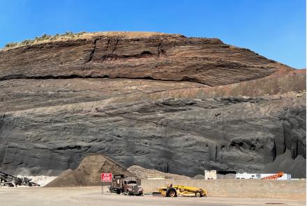
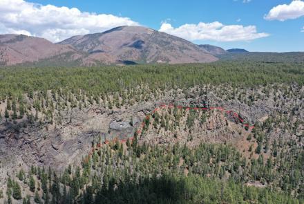
Geologic Hazard Mapping. The science of geologic hazard mapping has a fairly short but bright history. The late D.R. Crandall (U.S. Geological Survey) established the framework for hazard mapping with his seminal work on mudflows, flooding, and tephra hazards at Mount Rainier (Crandall, 1973) (Figure 2). Crandall and Donal R. Mullineaux pioneered geologic strategies for evaluating volcanic hazards and for conveying that information graphically to decision-makers and the public. Detailed geologic maps produced by state surveys and the USGS can provide information regarding areas that may be subject to flooding or landslides (including debris flows and rockfalls), locations of young faults, or less spectacular hazards such as unstable soils or earth fissures.

Geologic hazard maps are, however, technical tools and not easily consumed by civil authorities, decision-makers, and the public. To address that shortcoming, state geologic surveys have deployed an array of more palatable and intuitive resources to inform their constituents of the nature, distribution, and potential impact of geologic hazards (Table 1). With the advent of geographic information systems (GIS) state geological surveys are now broadcasting and promoting intuitive geologic hazard viewers e.g, ESRI’s ArcGIS Online) that are available to anyone with internet access (Figure 1).
Geologic hazard viewers are fast becoming an indispensable tool informing state, county, and community planning and environmental managers on designing safer more resilient built environment.. Some common hazard communication tools deployed by geologic surveys of the Western U.S. are bulleted in Table 1. A single exemplary example is provided by way of example.
Table 1. Geologic hazard features or activities supported by state geological surveys of the Western U.S.
• Geologic hazard viewer: e.g., Natural Hazards in Arizona;
• Geologic hazard theme pages: e.g., Earthquakes in California;
• Ask a Geologist: Ask a Geologist about Utah Geology
• Geologic hazard StoryMaps: The Bare Earth: How Lidar in Washington State Exposes Geology & Natural Hazards;
• Geologic hazards information distributed via social media: all western state geological surveys
• Geologic hazard(s) guide for the public: e.g., A Guide to Swelling Soils for Colorado Homebuyers and Homeowners
• Great ShakeOut Drop-Cover-Hold On annual event: all western state geological surveys
Last, a synergistic network of federal, state, county, tribal, municipal governments, and community activists and organizers engaging geoscientists, seismologists, engineers, urban designers, health and emergency managers, social scientists, and data scientists is critical for preparing for and mitigating geologic hazards and accompanying cascading events. State geological surveys play a pivotal role in identifying, evaluating and communicating geologic hazards to their state’s constituents.

Resources
Association of American State Geologists, 2019, Hazards, Fact Sheet.
Chen, Yong; Tsoi, Kam-Ling; Chen, Feibi; Gao, Zhenhuan; Zou, Qijia; Chen, Zhangli, eds. (1988), The Great Tangshan Earthquake of 1976: An Anatomy of Disaster, Oxford: Pergamon Press, p. 153.
Crandall D.R., 1973, Map showing potential hazards from future eruptions at Mount Rainier, Washington. US Geological Survey IMAP 836.
Hannah Ritchie and Max Roser (2014) - "Natural Disasters". Published online at OurWorldInData.org. Retrieved from: 'https://ourworldindata.org/natural-disasters';online resource]
Iverson, R.M.; George, D.L.; Allstadt, K.; Reid, M.E.; Collins, B.D.; Vallance, J.W.; Schilling, S.P.; Godt, J.W.; Cannon, C.M.; McGirl, C.S.; Baum, R.L.; Coe, J.A.; Schulz, W.H.; Bower, J.B. (2015). "Landslide mobility and hazards: implications of the 2014 Oso disaster". Earth and Planetary Science Letters. 412: 197–208.
Lowe, D.R., Williams, S.N., Leigh, H., Connort, C.B., Gemmell, J.B. and Stoiber, R.E., 1985, Lahars initiated by the 13 November 1985 eruption of Nevado del Ruiz, Colombia. Nature, v. 324, p. 51-53.
University of Washington Natural Hazards, 2020, https://hazards.uw.edu/geology
NOTE: The Association of American State Geologists (AASG) represents the State Geologists of the 50 United States and Puerto Rico. Founded in 1908, AASG seeks to advance the science and practical application of geology and related earth sciences in the United States and its territories, commonwealths, and possession.