The next generation of AZGS Digital Geologic Map products
Digital geologic maps are the currency of 21st century geology. At the Arizona Geological Survey (AZGS), we are revisiting our digital geologic map products to include geodatabases and open-source GeoJSON data compatible with a variety of platforms. This increases the usefulness and value of these maps for our stakeholders in the mining industry, government, environmental and hydrologic consulting community, and academia.
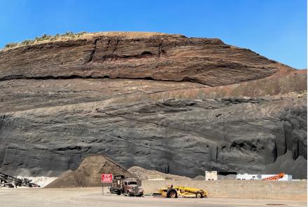
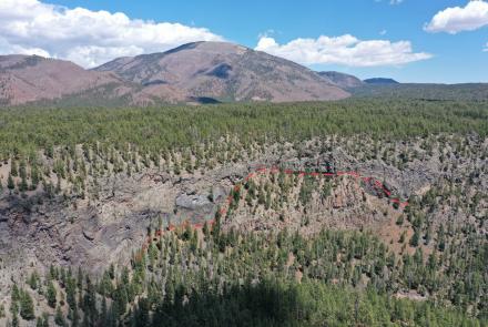
Geologic maps display the distribution of bedrock and alluvium, lithologic age relationships, and geologic structures – faults, folds and lineaments. Since 1915, the AZGS and its predecessor agencies have conducted geologic mapping and research. The resulting geologic maps and reports (e.g., bulletins, circular and open-file reports) have informed mineral exploration, infrastructure planning and construction, and geologic hazard identification and mitigation.
In 2000, AZGS established the Digital Geologic Map series (DGM). Static digital versions of those maps, along with the nearly 1,400 geologic maps and reports published between 1915 and 2019, are available free-of-charge at the AZGS Online Document Repository. In 2017, AZGS procured matching funds from the US Geological Survey (USGS) National Geological and Geophysical Data Preservation Program (NGGDPP) to revisit and upgrade the early products of our DGM series. The overarching goal is to make geologic map data available in a variety of digital formats to better meet the data needs of Arizona’s Earth sciences community.
AZGS data preservation objectives in 2018 were two-fold: 1) update existing geospatial databases for 20 geologic map quadrangles to make them congruent with current protocols of the USGS National Cooperative Geologic Mapping Program; and 2) work with the staff of the University of Arizona Library to build a second, archival AZGS repository served by UA Library Services to assure long-term data sustainability and accessibility.
AZGS Foray into Digital Maps. In 2000, the AZGS migrated from hand-drafted maps to digital maps built in ESRI’s GIS ArcINFO and ArcGIS software applications. The first AZGS digital products were high-resolution PDF map images solely available on compact disks (CDs) that sold for $25 to $35. These raster images could be brought into a GIS environment, georectified and added to existing data. Moving to a digital map platform held out the promise of ease of map revisions and timely updates; eventually, we made the maps available for free online, where they could be accessed 24/7, 365 days a year. The PDF format, however, lacked an underlying database and was not open to digital inquiry or modification.
Migrating from hand-drafted to digital maps was, however, fraught with difficulty. It required geologists to enter the labyrinth of GIS software. And as GIS products evolve, AZGS staff data management skills had to keep pace with technological enhancements to migrate digital databases across GIS platforms and to manage, curate, and archive-swelling terabytes of data. Primarily as a result of changing GIS software and geodatabase structure, the digital data associated with most of our DGMs produced prior to 2011 was not actually usable either internally or externally.
The Next Generation of Digital Map Products. With funds from the NGGDPP, we revisited our early digital map products to bring them into congruence with the ‘National Cooperative Geologic Map Program 09‘ (NCGMP09) standards; now referred to as GeMS – Geologic Map Schema. (Source: https://ngmdb.usgs.gov/Info/standards/GeMS/#bk; for additional information on GeMS, contact the US Geological Survey’s GeMS team at gems@usgs.gov.)
Our chief goals for 2018-2019:
i. Bring 20 digital geologic maps up to NCGMP-09 digital map standards (Table 1).
ii. Provide stakeholders and user audience with spatial map products that can be used in a variety of software programs – geodatabase and open source GeoJSON files – for the 20 DGM products
iii. Partner with staff of the University of Arizona Library staff to build a permanent digital archive of AZGS products in the University of Arizona (UA) Library system.
Our Data Preservation team comprises a GIS technician - for converting older spatial data formats into the NCGMP09 format; five geologists reviewing and revising four geologic maps each; a layout specialist to produce a map product consistent with AZGS publication standards; and an individual to upload the maps to the document repository and inform AZGS stakeholders of their release.
A suite of digital and geospatial products were constructed and released for each of the 20 maps (Table 1.); each map product carries an ISO19115 metadata record as well.
Table 1. Digital map products released as part of AZGS Data Preservation project.
• PDF (Plates and if available cross sections and text)
• Geodatabase
• Shapefiles (ESRI)
• Google Earth KMZ
• Open source GeoJSON representation for feature classes
Curating AZGS Geologic Map Products & Reports. According to Arizona State Geologist Phil Pearthree, “We believe that preserving and updating our digital geologic maps and map data is the highest priority issue for the AZGS and the geologic community in Arizona”. For decades, AZGS staff and its stakeholders took long-term sustainability of AZGS map products for granted. That ended abruptly in July 2016, when AZGS was transferred from state government to the College of Science at the University of Arizona without dedicated state funding. This unexpected transfer led to substantial staff reductions, decimated our physical library holdings of more than 13,000 geologic reports, texts and maps, and zeroed out our state allocation of $941,000.
The long-term prospects of AZGS' ~ 1,400 geologic products was unclear. One-hundred years of geologic map products and reports were threatened with extinction. In the event that AZGS was shuttered, what agency or institute would step up to curate and distribute these geologic products?
In the year following our departure from state government, our position at the University of Arizona stabilized. Our champions in the state legislature, supported by a diverse group of the customers for our geologic products, successfully re-established state funding for the survey at the 2015 levels of $941,000 annually. At the same time, AZGS staff strategized with UA Library Services on how to preserve this wealth of geologic knowledge.
For the foreseeable future, map products and geologic reports will continue to be served from the AZGS Document Repository. To assure for long-term preservation, the University of Arizona Library Services built the Arizona Geological Survey Collection at the University of Arizona Campus Repository. This new repository will mirror the existing AZGS repository; all new geologic map and reports will be hosted at both repositories. This redundancy of data archiving assures long-term sustainability.
We are currently working on updating another 20 DGMs with funding from the NGGDPP and the AZGS. These revised map products should be complete in September 2019, so look for them to be released to the public in the fall of 2019.
Table 2. Twenty digital geologic maps now accompanied by geospatial databases. These map products can be downloaded at no cost at the AZGS Online Document Repository. And soon they will be available through our Digital Geologic Map Download & Conversion Tool.
|
Digital Geologic Map # |
Topographic Map |
Citation |
|
DGM-68 |
Clark Ranch |
Gootee, B.F., Spencer, J.E., Ferguson, C.A., Richard , S.M., Cook, J.P., and MacFarlane, B.J., 2018, Geologic Map of the Clark Ranch 7½ ’ Quadrangle and west half of the Rhodes Peak 7 ½ ’ Quadrangle, Pinal and Graham Counties, Arizona: Arizona Geological Survey Digital Geologic Map 68 (DGM-68), version 2.0, 1 sheet, sc ale 1:24,000, with text |
|
DGM-45 |
Davis Dam |
Pearthree, Philip, A., and House, P. Kyle, 2005, Geologic Map of the Davis Dam SE 7.5' Quadrangle, Mohave County, Arizona, and Clark County, Nevada: Arizona Geological Survey Digital Geologic Map DGM-45, version 1.0, map scale 1:24,000. |
|
DGM-50 |
Fairbank |
Ferguson, C.A., Shipman, T.C., Pearthree, P.A., Moore, E.N., Richard, S.M., Spencer, J.E., Youberg, A., Cook, J.P., and Haddad, D.E., 2018, Geologic Map of the Fairbank 7½' Quadrangle, Cochise County, Arizona: Arizona Geological Survey Digital Geologic Map 50 (DGM- 50), version 3.0, 1 sheet, layout scale 1:24,000, with text. |
|
DGM-57 |
Hereford |
Cook, Joseph, P., Shipman, T.C., and Pearthree, P.A., 2018, Geologic Map of the Hereford 7.5’ Quadrangle and the Northern Part of the Stark 7.5’ Quadrangle, Cochise County, Arizona: Arizona Geological Survey Digital Geologic Map DGM-57, version 3.0, map scale 1:24,000, 12 p., 1 map sheet |
|
DGM-49 |
Land |
Shipman, T.C., Ferguson, C.A., Cook, J.P., and Haddad, D.E., 2009, Geologic Map of the Land 7½' Quadrangle, Cochise County, Arizona: Arizona Geological Survey Digital Geologic Map 49 (DGM-49), version 2.0, 1 sheet, layout scale 1:24,000. |
|
DGM-51 |
Lewis Springs |
Pearthree, P.A., Ferguson, C.A., Demsey, K.A., Haddad, D.E., and Cook, J.P., 2018, Geologic Map of the Lewis Springs 7½’ Quadrangle, Cochise County, Arizona: Arizona Geological Survey Digital Geologic Map 51 (DGM-51), version 3.0, 1 sheet, layout scale 1:24,000. |
|
DGM-66 |
Lookout Mountain |
Young, J.J., Spencer, J.E., MacFarlane, B.J., and Richard, S.M., 2009, Geologic Map of the Lookout Mountain 7.5’ Quadrangle, Pinal county, Arizona: Arizona Geological Survey Digital Geologic Map DGM-66, v 2.0, map scale 1:24,000, 14 p. and 1 map sheet. |
|
DGM-96 |
Middle Water Spring |
Johnson, B.J., Pearthree, P.A., and Ferguson, C.A., 2011, Geologic map of the Middle Water Spring 7 ½' Quadrangle, Mohave County, Arizona: Arizona Geological Survey Digital Geologic Map DGM-96, v 1.0, scale 1:24,000. |
|
DGM-53 |
Needles |
Pearthree, P.A., 2018, Geologic Map of the Needles NE 7.5’ Quadrangle, Mohave County, Arizona. Arizona Geological Survey Digital Geologic Map, DGM-53 v2.0, 14 p., map scale 1:24,000 (1 sheet). |
|
DGM-69 |
Peppersauce Wash |
Pearthree, Philip A., Cook, Joseph P., Skotnicki, Steven J., and Spencer, Jon E., 2009, Geologic Map of the Peppersauce Wash 7.5’ Quadrangle, Pinal and Pima Counties, Arizona: Arizona Geological Survey Digital Geologic Map DGM-69, version 1.0, map scale 1:24,000, 15 p. and 1 map sheet. |
|
DGM-60 |
Redington |
Spencer, E.J., and Cook, J.P., 2018, Geological Map of the Redington 7.5’ Quadrangle, Cochise, Graham, and Pima Counties, Arizona: Arizona Geological Survey Digital Geologic Map DGM-60, version 3.0, map scale 1:24,000, 13 p. and 1 map sheet. |
|
DGM-48 |
Saint David |
Youberg, A.M., Cook, J.P., 2018, Geologic Map of the Saint David 7½’ Quadrangle, Cochise County, Arizona: Arizona Geological Survey Digital Geologic Map 48 (DGM-48), version 3.0, 1 sheet, layout scale 1:24,000 |
|
DGM-88 |
Somerton |
Youberg, A., 2011, Geologic Map of the Somerton 7 1/2’ Quadrangle, Yuma County, Arizona: Arizona Geological Survey Digital Geologic Map DGM-88, version 1.0, map scale 1:24,000. |
|
DGM-61 |
Soza Canyon |
Spencer, J.E., Richard, S.M., Cook, J.P., Dickinson, W.R., Lingrey, S.H., and Guynn, J.H., 2018, Geologic Map of the Soza Canyon 7½’ Quadrangle, Cochise and Pima Counties, Arizona: Arizona Geological Survey Digital Geologic Map 61 (DGM-61), version 2.0, 1 sheet, layout scale 1:24,000, with text version 3.0. |
|
DGM-42 |
Star Well |
Youberg, Ann, Spencer, Jon E., and Ferguson, Charles A., 2004, Geologic Map of the Star Well 7.5' Quadrangle, Maricopa County, Arizona: Arizona Geological Survey Digital Geologic Map DGM-42, version 1.0, map scale 1:24,000. |
|
DGM-38 |
Wagner Wash Well |
Ferguson, Charles, A., Spencer, Jon, E., Pearthree, Philip, A., Youberg, A., and Field, John, J., 2004, Geologic Map of the Wagner Wash Well 7.5' Quadrangle, Maricopa County, Arizona: Arizona Geological Survey Digital Geologic Map DGM-38, version 1.0, map scale 1:24,000. |
|
DGM-02 |
Waterman Peak |
Richard, S.M., Ferguson, C.A., Spencer, J.E., Youberg, Ann, and Orr, T.R., 2000, Geologic Map of the Waterman Peak 7.5' Quadrangle and northern La Tortuga Butte 7.5' Quadrangle, Pima County, Arizona: Arizona Geological Survey Digital Geologic Map DGM-02, version 1.0, map scale 1:24,000, 30 p., 1 map sheet. |
|
DGM-62 |
Wildhorse Mountain |
Spencer, Jon E., Cook, Joseph P., Lingrey, Steven H., Richard, Stephen M., and Guynn, Jerome H., 2009, Geological Map of the Wildhorse Mountain 7.5 Quadrangle, Cochise County, Arizona: Arizona Geological Survey Digital Geologic Map DGM-62, version 2.0, map scale 1:24,000, 18 p. and 1 map sheet. |
|
DGM-86 |
Yuma East |
Youberg, A., Spencer, J.E., and Pearthree, P.A., 2011, Geologic Map of the Yuma East 7.5’ Quadrangle, Yuma County, Arizona: Arizona Geological Survey Digital Geologic Map DGM-86, version 1.0, map scale 1:24,000. |
|
DGM-87 |
Yuma SE |
Pearthree, P.A., 2012, Geologic map of the Yuma Southeast 7.5’ Quadrangle, Yuma County, Arizona: Arizona Geological Survey Digital Geologic Map DGM-87, version 1.0, map scale 1:24,000 |
ACKNOWLEDGMENTS
Funding for this digital geologic map project provided by the US Geological Survey’s National Geological and Geophysical Data Preservation Program, award no. G17AP00114.